|
Georgian mountains
Picture Georgia as a system of hills and plains between two mountain systems: the Greater Caucasus in the north and the Lesser Caucasus in the south.
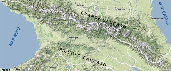
Even though in the Lesser Caucasus can be found interesting scenery, an important national park (Borjomi), world class historical and archeological sites (Vardzia, Uplistsikhe, Dmanisi), to find the most breathtaking mountains, you have to go up north.
The Greater Caucasus range goes from the Black Sea to the Caspian Sea, from Northwest to Southeast, it can easily be divided in 3 parts: Western, Central and Eastern.
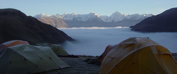
Geologically speaking, the Caucasus mountains are very "young" and this is a reason for their being so stunning. Mountain summits look like peaks, towers, pyramids. "U"shaped valleys, narrow canyons. The effects of the seismic activity can be easily seen, along with the erosion effects of the wind, the rivers and the glaciers.
Climate
The Greater Caucasus climate is determined by its southern orientation, by its proximity to the Black Sea and the Mediterranean and by the considerable height of its mountains.
These summits pose a formidable barrier to hot air masses coming from the west. South-west slopes (Abkazia e Svaneti) get an annual precipitation of 2500 mm.
In the East precipitations are in the range of 600 mm per year. The northern slopes of the Greater Caucasus are visibly drier then the south, as is evident in the arid mountains of Chechnya and Dagestan.
Historical Provinces
Georgia can be divided in provinces that do not coincide necessarily with current administrative entities, but that are historically, socially and culturally homogeneous.
The provinces we considered are the ones we know best: Khevi, Khevsureti and Tusheti. We will soon add informations regarding a fourth province, Svaneti.
|
 |